
This is the last stretch of the Louth Navigation as it enters Louth and the final destination at the town's Riverhead.
The first few photo's are of two Humber Keelboats, typical of the vessels that once navigated along the canal, the Amy Howson & Comrade. My son and I had a trip along the Humber Estuary quite a few years ago on Amy Howson, when I took these pictures. Both these vessels may well have made the trip inland to Louth when the canal was operating.


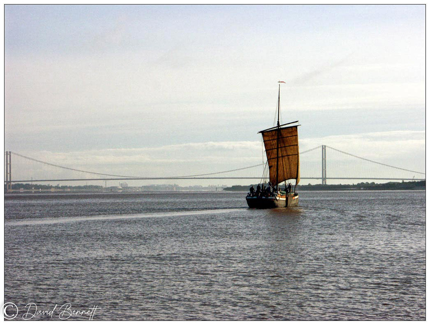 |
| "Comrade" approaching the Humber Bridge heading east along the Humber Estuary. Apart from the Humber Bridge nothing much will have changed in this scene. |
 |
| "Comrade" seen from the "Amy Howson" |
 |
| The tide was quickly turning and we needed to get back to South Ferriby. Both boats had been under sail all day but had to resort to diesel engines to beat the tide. No such luxury back in the days of sailing the Navigation, all boats were sail powered. |
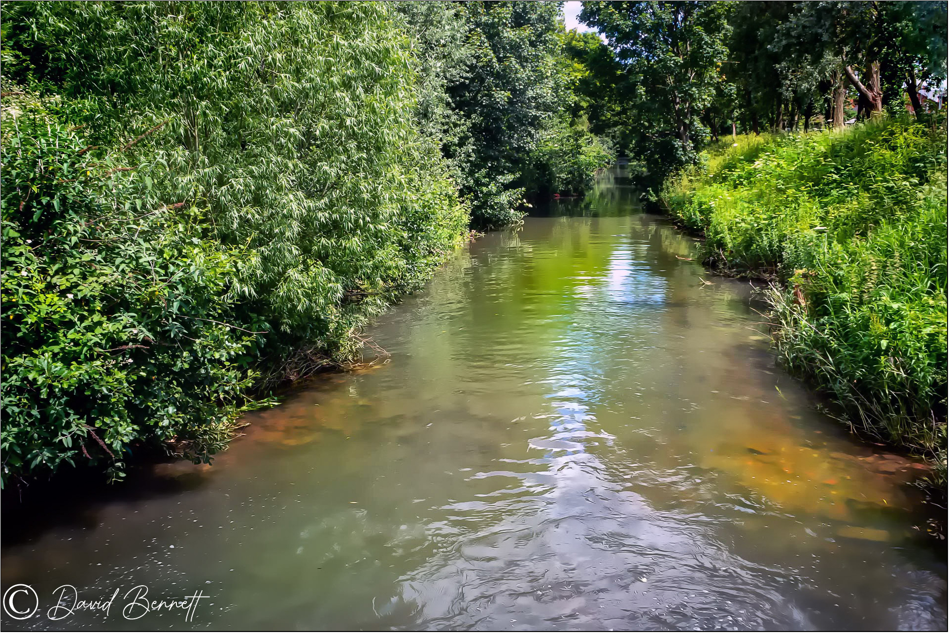 |
| The canal is now in the town of Louth heading along this quiet stretch. It's very overgrown and silted up but I still find it difficult to imagine how the keelboats were able to navigate the canal under sail only. |
 |
| This is "Top Lock" the last lock before reaching the Riverhead. Back in the days of the Navigation it would have been a traditional lock pit to handle the different depths of water but now it's a "Tilt Lock" to control the flow in times of heavy rain. |
 |
| Further along, Top Lock can be seen in the distance. |
 |
| The canal starts to enter what was once the heavily industrialised area around the Riverhead. A lot of the businesses have long since gone but many of the buildings remain. On the left This building has been renovated and made into apartments. |
 |
| A wild Mallow plant, maybe not so wild as folk sometimes throw garden waste away here. |
 |
| On the opposite side to the apartments is a new development of flats, built in the same style. And a lady with her dog in the distance. |
 |
| A lovely Ruby Cavalier King Charles came bounding up to me. (Had to get a doggy pic in somewhere!) |
 |
| The area on both sides of the canal here would have been all industrial building and quite a lot remain on the left side. To the right used to be a more modern haulage yard and I did telephone work there before I retired. It too has gone now and is a very nice area of modern flats. |
.jpg) |
| One of the building from the 1700's has been converted to a public house and brewery. |
 |
| Called "The Gaslamp" the lounge is lit by gas lamps only. |


 |
| Almost at journeys end now this was a wharf side warehouse back in the day. |
 |
| Now it's a mix of smart apartments and retail space. |
 |
| Looking from across the canal toward the smart apartment blocks I spotted an angler on the left. |
 |
| This is "Ted". Someone put him there several years ago and I photographed him on many occasions. |
 |
| This was the last time we saw him, he's long gone now. |
 |
| Navigation House on the right with the Woolpack pub beyond. |
 |
| The Woolpack dates back to the 1700's and would have been popular with the boatmen at the end of their journey. |
 |
| Navigation House was a transit storage warehouse but fell into disrepair after the canal closed. Louth Navigation Trust was formed in 1986 and this building, dating back to 1770 was restored in 1990 and the trust has it's office and a museum within it. Folk music festivals are held on this decked area in the summer months. |


 |
| "Navigation House", Riverhead at Louth. The last section of the canal reached Louth in May 1770 and Louth joined the elite of Humber ports enjoying huge prosperity as trade picked up. They were able to import coal, timber & building materials and export local grain, wool, oilseed and other products. Many businesses prospered around the Riverhead area:- Tanneries, timber yards, grain warehouses, a boat building yard, oil cake mills. Even after the railway came to Louth in 1848 trade increased as it meant businesses could trade with the midlands as well as the Humber ports and around 20 Keelboats a week arrived. The town of Louth prospered and in 1790 received more fresh fish than Grimsby. Trade began to decline from the 1880's and declined further by WW1. The final blow came on 29th May 1920 when torrential rain up on the Lincolnshire Wolds caused a massive flood. A wall of water raced through the town, homes and businesses were destroyed, 23 people died. The flash flood almost wiped out the Riverhead area and it's businesses, Humber Keelboats were lifted completely out of the dock basin, washed downstream and piled against Top Lock. After four years of debate a government closure order was obtained and the Louth Navigation closed in 1924. Canal buildings were sold off, the lock gates removed to re-use the heavy timbers and all the swing bridges replaced with fixed road bridges. The Louth Navigation Trust have spent many years trying to preserve what remains of the canal and make it useable for small pleasure craft and maybe one day, full restoration. So that's the end of this project, I must give credit to the Louth Navigation Trust for providing all the history and information I've given. |
David, as you might imagine I loved this post. Those beautiful humber keels, especially the one under sail, are food for my soul. I also enjoyed the final stretches of the navigation and the photos of the old wharf buildings that are now flats. The pubs are very attractive too. Lovely photos and interesting history, and, of course, the dog. What a sweetie!
ReplyDeleteThanks Val, I thought you might enjoy this post. The trip my son & I had along the Humber Estuary on the Amy Howson was a real photographic highlight for me. To sail SILENTLY under a canvas sail is a strange experience.
ReplyDeleteThank you for commenting, always appreciated, David.
Absolutely superb. Must have been a perfect trip, with your son on, the Amy Howson, something to remember. Thank you for an interesting read. Trust you are gradually getting back to health. Good wishes.
ReplyDeleteThank you Mike, it was an interesting project, both in the taking of the photo's and gathering the information. I've started another project, thr RNLI are building a new lifeboat station at Cleethorpes and I hope to do a photo essay of it
DeleteI'm progressing well and have been told that AT THE MOMENT, the cancer has gone but I'll be monitored for the next 5 years. I remember you getting that good news.
Hello David, very interesting to see this stretch of your brilliant project. Ahh, the famous Humber Bridge heights! Amy Houson looks like the perfect way to travel, you and your son must have loved it. Now, the Gas Lamp looks like my kind of pub. I remember there being a fab gas lit pub in Beverley, East Yorks. Take care x
ReplyDeleteThanks for your recent comments, on two posts they haven't appeared yet but I was able to read them on the email notifications, thank you Lulu. David.
DeleteOur trip on the Amy Howson was a unique experience, I've enjoyed doing this project. Thanks for your comments on it Lulu.
ReplyDelete